So with each player having been provided with the
Operation Orders (which also includes their TO&Es for the beginning of the
campaign) and the map sets it was up to them to start working out how they
would tackle the tactical situation.
The Danish went with what might have been the simplest
option from their initial set-up shown below.
One Mech platoon would move north to block the northern beach exit, one Mech platoon would move south to block the southern exit while the last Mech platoon in Faxe would move towards the beach - really to the edge of town to back up the recce and Homeguard units positioned there. Something like this:
The Danes pretty much expect the main Soviet thrust will come straight down the central road as it is the fastest route to what the Danes think is the Soviet primary objective beside securing the beachhead.
The Soviet plan was also pretty simple. So simple I can't really see the need to draw a map for it. The plan was upon landing to push their limited recce down the central beach exit route until it discovered Danish positions. Upon discovery (and assuming they survived the encounter) the BRDMs would either double back or use side roads to move north and push up the northern route until they came into contact again. If the made it out of that one alive they would skedaddle back to Faxe Ladeplads and the recce the southern route.
In the meantime, once they got themselves organised from the landing the BTR equipped company would charge down the main road and try and bounce the first Danish positions previously reconnoitered by the BRDMs. Tanks and other assets that landed in the first wave would basically move to the sound of the guns while the second wave started landing.
Troops without vehicles would help secure Faxe Ladplads and push north and south to prepare immediate defensible positions whilst waiting for their vehicles to arrive.
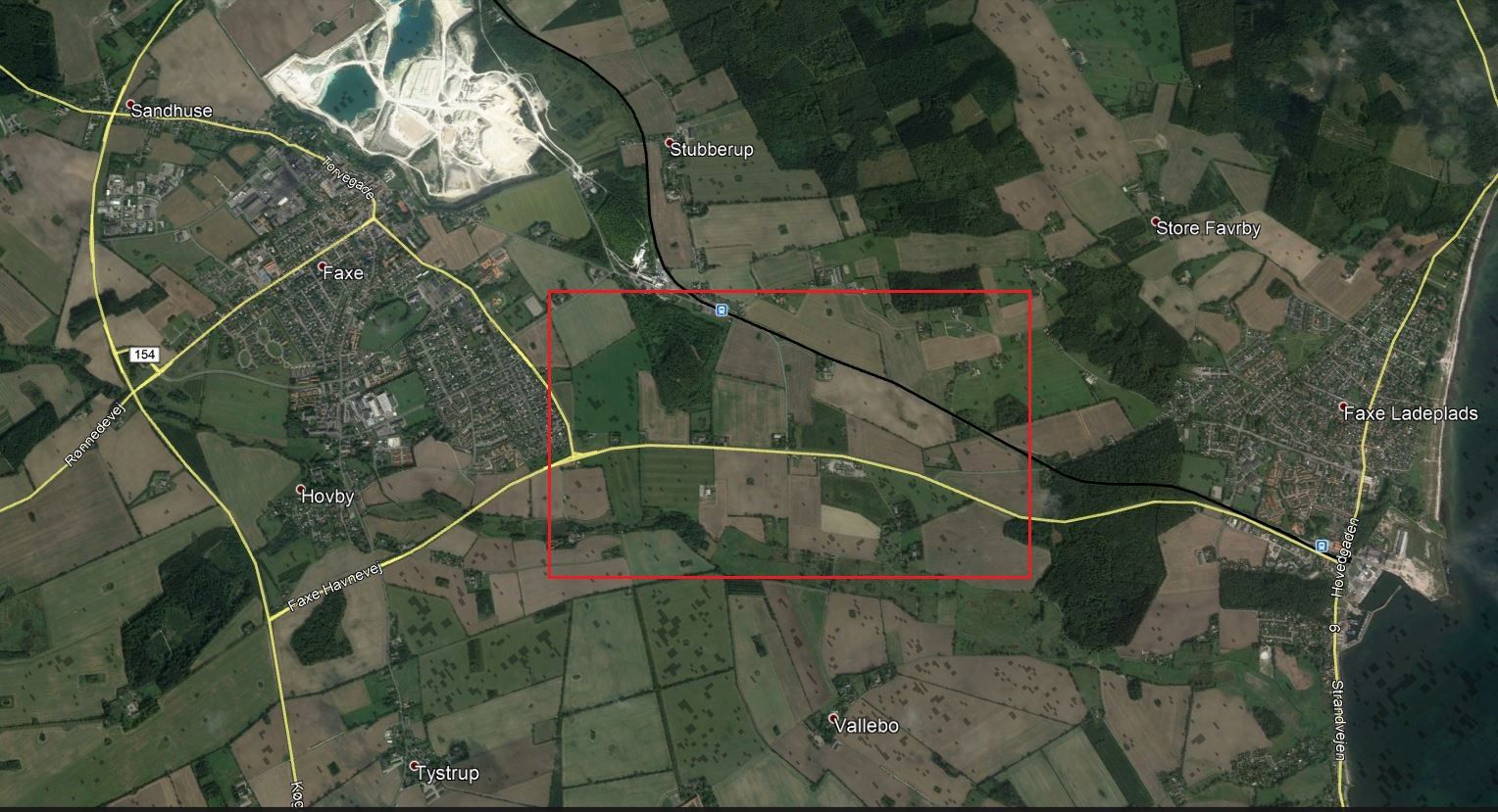
So - the first clash would take place on the central route directly in front of Faxe with the table attempting to replicate the area in the red box below.
To get my total nerd on, I used Google Maps to virtually "drive" down the central route towards Faxe, looking for specific terrain features. The main thing I got out of that was that the two heavily wooded sections on the table (inside the red box) were both actually raised areas or small hills. The woods or dense scrub is so dense I decided vehicular movement would be even more restricted than normal difficult terrain and as it has been raining non-stop all off-road movement would count as difficult terrain. The other factor cause by the weather was that all weapons with Thermal sights (meaning essentially TOW ATGM only) would be +1 to hit.
So this is the table from the Soviet end. The edge of Faxe can be seen in the distance, along with a small and larger hill on the right hand side of the road.
Here's the table from the Danish point-of-view.
Again you sould be able to see the two hills pretty clearly here. But just in case you can't - here's the big hill (which is in the Danish deployment zone):
And the little hill which is on the Soviet's side of the table:
And that's it for the table set up.
Next up - the AAR.
Thanks
Richard


Looking great 👍
ReplyDeleteThanks mate!
DeleteRichard